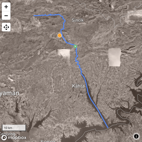
Since Monday, the #PleiadesGazetteer editorial college has published 15 new and 41 updated place resources, reflecting the work of 10 people. The usual Monday blog post will summarize a full week's worth of such work, but meantime here's a #SneakPeek at an update to a place resource originally derived from a Barrington Atlas feature. Tom Elliott has recently worked on the entry for the Chabina river, a tributary of the Euphrates in eastern Turkey whose course incorporated portions of three drainages that are differently named today: https://pleiades.stoa.org/places/658430
Among the updates: detailed modern geometry from OpenStreetMap and modern toponyms sourced from the BAtlas directory and other sources. References have been cleaned, and a link added for the IGLSyr reference to the digitized copy at Persée, whence the Latin name. A connection has also been made to the record for the Cendere Bridge, findspot of the inscriptions.
#ancientGeography #ancientHistory #archaeology #DH #gazetteers #HGIS