Discussion
Loading...

Post

  • About
  • Code of conduct
  • Privacy
  • About Bonfire
Grant_H
@grant_h@mastodon.social  ·  activity timestamp 3 days ago

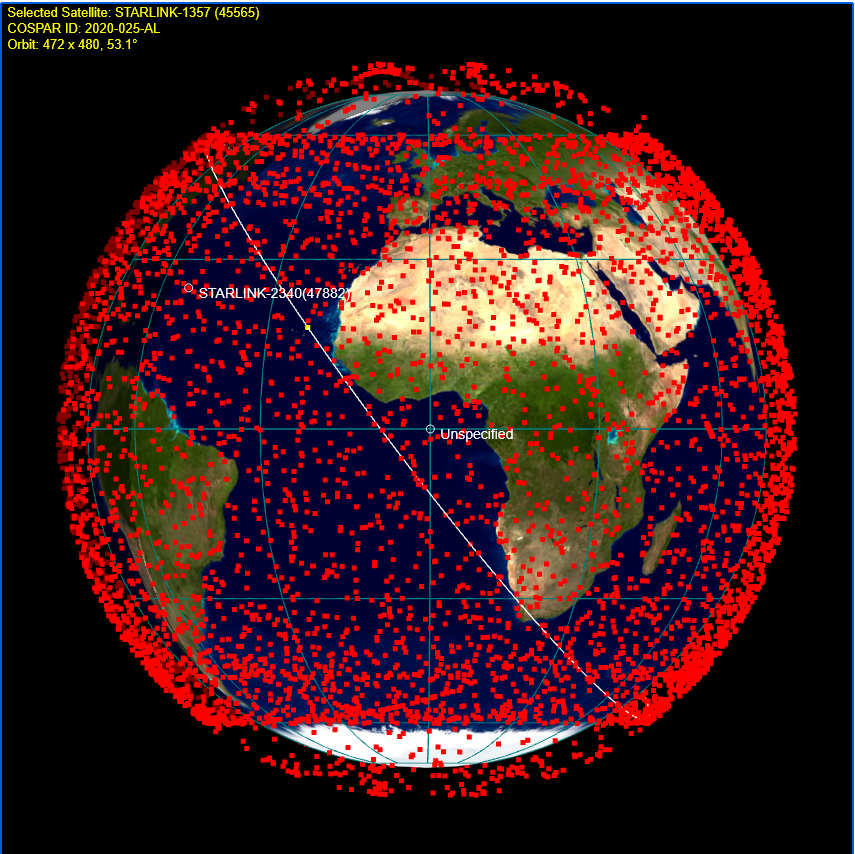
I have read a lot about the impact of Starlink on the night sky, and have seen the "trains" of newly launched satellites. But today I saw this map, which plots them all, in real time. Or you can speed it up a bit.

I understand there are plans to put up at least two more constellations this dense. I have no words.

@sundogplanets Have you seen this site- it makes the point rather starkly.

#astronomy #starlink

https://www.heavens-above.com/StarLink.aspx?lat=0&lng=0&loc=Unspecified&alt=0&tz=UCT

Starlink - dynamic 3D orbit display
Satellite predictions and other astronomical data customised for your location.
A simulated view of the whole Earth from deeper space. 1000's of red squares are seen, each representing the current position of a Starlink Satellite.
  • Copy link
  • Flag this post
  • Block
Log in

Bonfire Dinteg Labs

This is a bonfire demo instance for testing purposes. This is not a production site. There are no backups for now. Data, including profiles may be wiped without notice. No service or other guarantees expressed or implied.

Bonfire Dinteg Labs: About · Code of conduct · Privacy ·
Bonfire social · 1.0.0-rc.3.15 no JS en
Automatic federation enabled
  • Explore
  • About
  • Code of Conduct
Home
Login